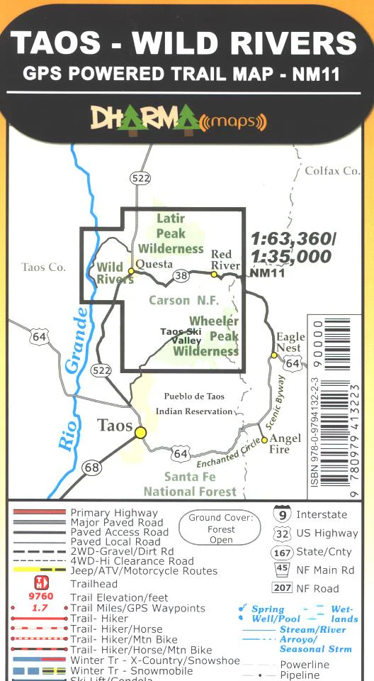
Map: Taos-Wild Rivers (Dharma Maps) NM
A synthetic, tear proof, water resistant map which covers the Wild Rivers BLM Recreation Area north of Taos within the Rio Grande del Norte National Monument. Trails, roads, and camp sites are included. The Red River flows into the Rio Grande River at a viewpoint above the rivers. Also included is the Wheeler Peak area of the Carson National Forest with trails, roads, and campsites. GPS is available. Scenic driving from Taos to Red River and Questa. Visit the Red River Fish Hatchery. 2010
Original: $9.95
-65%$9.95
$3.48Product Information
Product Information
Shipping & Returns
Shipping & Returns
Description
A synthetic, tear proof, water resistant map which covers the Wild Rivers BLM Recreation Area north of Taos within the Rio Grande del Norte National Monument. Trails, roads, and camp sites are included. The Red River flows into the Rio Grande River at a viewpoint above the rivers. Also included is the Wheeler Peak area of the Carson National Forest with trails, roads, and campsites. GPS is available. Scenic driving from Taos to Red River and Questa. Visit the Red River Fish Hatchery. 2010


